May 6, 2026
Wet and warm pattern ahead

This blog covers the Washington DC Area. Please consider subscribing for emails in your inbox every morning and to join my live chat which will be active during active weather.
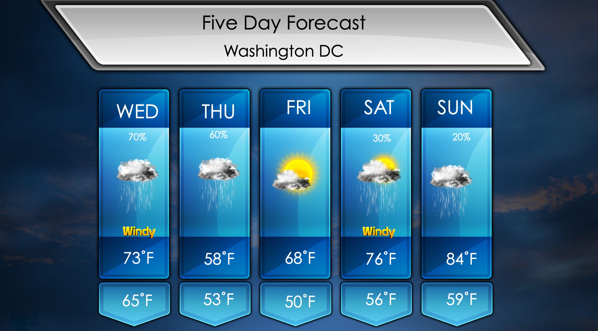
Good morning everyone! Warmer day with windy conditions most of the day. Two round of rain will be expected the next two days. First one will be this morning ending in the early afternoon. We will then get a break before second round comes late tonight. Heaviest will be overnight, but leftovers periodically during the day. Rain chances for the next several days after that.
Rain begins around 7:00 AM today and will wrap up by 1:00 PM. Morning temperatures will be in the mid 60s with rain ongoing. Remaining warm in the afternoon with highs in the low 70s. Windy most of the day with highs up to 25 mph, clouds will be present all day.
Second round of rain this week begins overnight into tomorrow morning with heaviest rain. There might be some thunder during the night front due to cold front passing. Scattered showers throughout the day as well. Morning temperatures will be in the low to mid 50s with showers. Watch for showers continuing during the afternoon with temperatures not getting much warmer in the upper 50s.
Dry day is expected on Friday with pleasant temperatures. Getting out the door, temperatures will be near 50˚F with sunshine. Afternoon highs get comfortably into the upper 60s with passing clouds. It’ll be a nice day in a fairly rainy pattern.
Monitoring chance for light showers Saturday. Morning temperatures will be in the mid 50s with rainfall possible. Sunny day in the afternoon with highs in the mid 70s.
We will need to watch out for more rain Sunday, still too soon to determine how much but for now it will be in the forecast. Morning temperatures will be in the upper 50s with plenty of clouds. Rain possible in the afternoon with highs in the mid 80s.